


Land Use Cover Remote Sensing Dataset
#object detection #image segmentation #land monitoring #agricultural planning #environmental assessment
- 20000 records
- 5G
- JPG/PNG/JSON
- CATL
 MOBIUSI INC
Updated:2026-07-30
AI Analysis & Value Prop
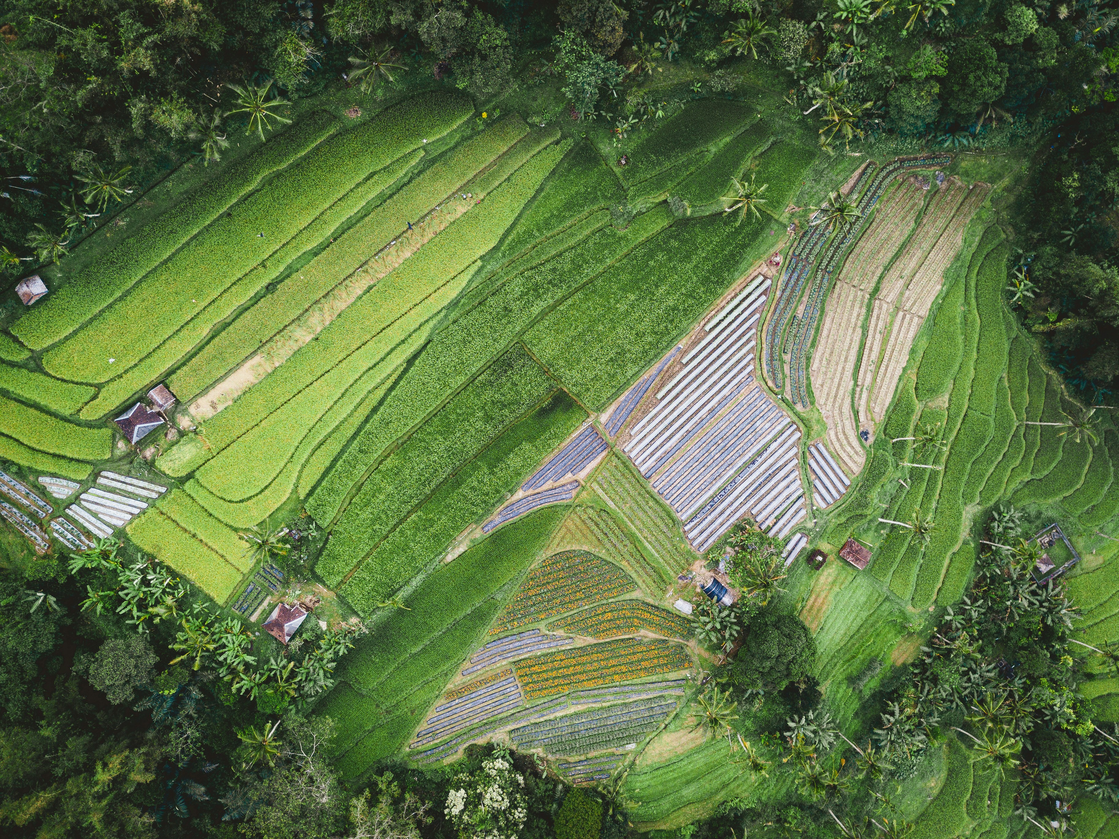
The current agricultural sector faces rapid depletion of land resources and environmental changes. Especially against the backdrop of global climate change, efficient monitoring of land use has become particularly important. Existing remote sensing datasets are mostly focused on urban areas with insufficient attention to agricultural land coverage, leading to a lack of data support for agricultural planning and environmental assessment. This dataset aims to provide a high-quality land use cover remote sensing dataset to address the technical needs for object detection in remote sensing images within the agricultural field. Data collection uses high-resolution remote sensing satellite images covering agricultural land nationwide, ensuring diversity and applicability of the data. We ensure high quality and consistency through multiple rounds of annotation and expert review. The storage format is JPG, organized by category to facilitate subsequent use and analysis.
Dataset Insights
Sample Examples
9fdd0647**.jpg|3656*2740|4.29 MB

2ce6e041**.jpg|5472*3648|6.90 MB


Technical Specifications
| Field | Type | Description |
|---|---|---|
| file_name | string | File name |
| quality | string | Resolution |
| object_category | string | The category of the agricultural-related object detected in the image, such as paddy field, orchard, forest, etc. |
| object_count | int | The number of objects detected in the image. |
| land_cover_type | string | The type of land cover in each area of the image, such as grassland, water body, bare land, etc. |
| sensor_type | string | The type of sensor used to acquire the image, such as optical sensor, radar sensor, etc. |
Compliance Statement
| Authorization Type | Proprietary - Commercial AI Training License (No Redistribution) |
| Commercial Use | Requires exclusive subscription or authorization contract (monthly or per-invocation charging) |
| Privacy and Anonymization | No PII, no real company names, simulated scenarios follow industry standards |
| Compliance System | Compliant with China's Data Security Law / EU GDPR / supports enterprise data access logs |
Frequently Asked Questions
- What is the Land Use Land Cover Remote Sensing Dataset?
- The Land Use Land Cover Remote Sensing Dataset is a high-quality dataset used for analyzing and detecting land use and cover conditions in the agricultural sector. It contains a large amount of image data suitable for object detection tasks.
- In which agricultural research areas can this dataset be applied?
- This dataset can be applied in research areas such as agricultural planning, crop monitoring, and natural resource management, providing support for precision agriculture.
- How can this dataset be used for object detection?
- Machine learning and deep learning algorithms can be used to train and test images in the dataset to identify and classify different types of land use and land cover.
- What are the advantages of this dataset in agriculture?
- This dataset provides detailed information on land cover and use, helping agricultural professionals optimize resource allocation, improve production efficiency, and enhance decision-making strategies.
- What is the importance of object detection in agricultural remote sensing?
- Object detection can automate the identification and classification of surface features, improving the efficiency and accuracy of remote sensing image analysis, enabling rapid acquisition of agricultural information for timely decision-making.

Can't find the data you need?
Post a request and let data providers reach out to you.
Get this Dataset
Verified for Enterprise UseCite this Work
@dataset{Mobiusi2025,
  title={Land Use Cover Remote Sensing Dataset},
  author={MOBIUSI INC},
  year={2025},
  url={https://www.mobiusi.com/datasets/6ff37b260e3595af1347351b14f99fd7},
  urldate={2025-09-15},
  keywords={remote sensing dataset, agricultural object detection, land use monitoring, remote sensing image, dataset},
  version={1.0}
}
Using this in research? Please cite us.
placeholder
placeholder
placeholder
placeholder
placeholder
placeholder
placeholder