


Farmland Flood Disaster Identification Dataset
#object detection #image classification #flood disaster monitoring #farmland management #agricultural insurance
- 5000 records
- 1.5G
- JPG/PNG/JSON
- CATL
 MOBIUSI INC
Updated:2026-06-05
AI Analysis & Value Prop
The current agricultural industry faces frequent flood disasters due to climate change, which severely affects farmland production, leading to reduced crop yields and economic losses for farmers. Existing monitoring methods usually rely on manual inspection, which is inefficient and difficult to provide real-time feedback. To better address this challenge, this dataset aims to provide a farmland image dataset with different levels of flood impact to support AI models in automatic identification and analysis. Data collection is conducted using high-resolution cameras at different times and locations, ensuring coverage of various flood situations. For data quality control, multiple rounds of annotation and expert review ensure annotation consistency and accuracy. The data storage format is JPG, organized by time and location, facilitating subsequent analysis and application.
Dataset Insights
Sample Examples
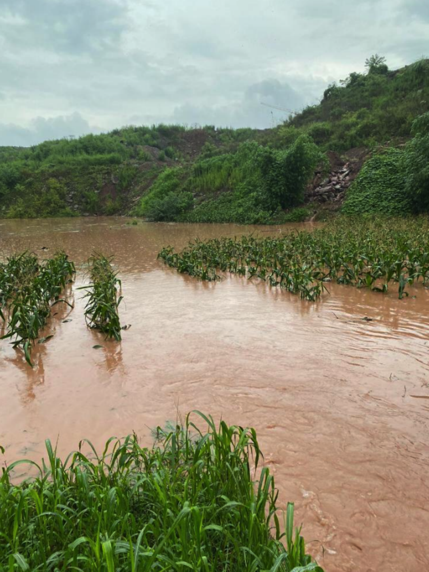
aa8cd907**.png|1499*2000|3.85 MB
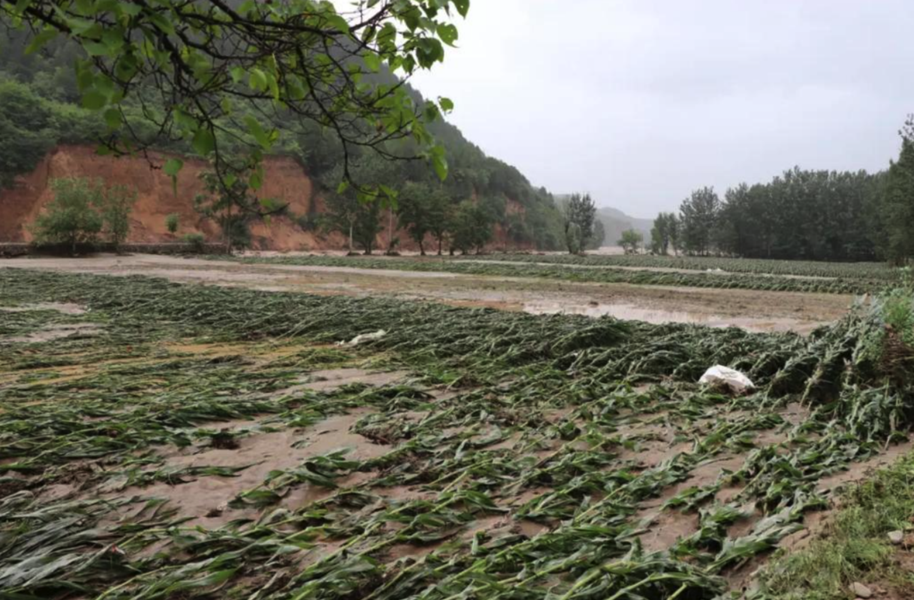
5108179e**.png|3045*2000|6.87 MB

a91d2034**.png|1688*2000|3.98 MB

5dd4546f**.png|1604*2000|2.94 MB


Technical Specifications
| Field | Type | Description |
|---|---|---|
| file_name | string | File name |
| quality | string | Resolution |
| crop_type | string | The type of crop primarily grown in the flooded area. |
| flood_severity | string | The severity of the flooding impact on the farmland, such as mild, moderate, or severe. |
| vegetation_health | string | A description of the health status of the vegetation, such as healthy, damaged, or dead. |
| damage_estimation | float | An estimate of economic loss caused by the flood, measured in local currency. |
| irrigation_status | string | The irrigation status of the farmland before flooding, such as normal, over-irrigated, or water-deficient. |
Compliance Statement
| Authorization Type | Proprietary - Commercial AI Training License (No Redistribution) |
| Commercial Use | Requires exclusive subscription or authorization contract (monthly or per-invocation charging) |
| Privacy and Anonymization | No PII, no real company names, simulated scenarios follow industry standards |
| Compliance System | Compliant with China's Data Security Law / EU GDPR / supports enterprise data access logs |
Frequently Asked Questions
- What is the Farmland Flood Disaster Identification Dataset?
- The Farmland Flood Disaster Identification Dataset is an object detection dataset used to identify the impact of floods on farmland, aiming to advance intelligent management in agriculture.
- How is this dataset applied to agricultural management?
- By using image recognition to identify flood disasters, this dataset helps agricultural managers assess and respond to the impact of floods on farmlands, thereby optimizing agricultural production and disaster prevention strategies.
- What data modalities does the Farmland Flood Disaster Identification Dataset include?
- The dataset primarily includes image data for flood identification in object detection tasks.
- How does this dataset enhance intelligent agricultural management?
- By identifying and monitoring the impact of floods on farmland, the dataset provides accurate data support, aiding in intelligent decision-making and reducing disaster-related losses.
- What are the application scenarios for the Farmland Flood Disaster Identification Dataset?
- The dataset is widely used in agricultural monitoring, disaster response, agricultural production optimization, and for researchers developing related algorithms.

Can't find the data you need?
Post a request and let data providers reach out to you.
Get this Dataset
Verified for Enterprise UseCite this Work
@dataset{Mobiusi2025,
  title={Farmland Flood Disaster Identification Dataset},
  author={MOBIUSI INC},
  year={2025},
  url={https://www.mobiusi.com/datasets/4a0c67bb5f940b23a526688e41e7a588},
  urldate={2025-09-15},
  keywords={flood disaster, farmland monitoring, object detection dataset, agricultural AI, disaster identification},
  version={1.0}
}
Using this in research? Please cite us.
placeholder
placeholder
placeholder
placeholder
placeholder
placeholder
placeholder